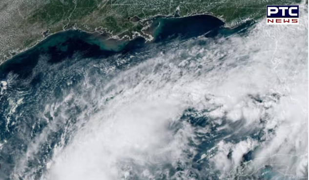
Milton is threatening to strike Florida’s Big Bend, less than two weeks after Hurricane Helene did. However, due to the state’s peculiar shoreline, the new storm system might be the worst in over a century for parts of west-central Florida. With the recent effects of Helene, Debby, Ian, and Idalia, the area is clearly tired of storms. Meanwhile, the FOX Forecast Center warns that the situation is similar to what emergency managers have anticipated and prepared for for decades due to the odd angle of attack.
Because of the wind direction and distance from the Category 4 hurricane’s center, cities south of Florida’s Big Bend experienced storm surges averaging 5-8 feet during Helene, which was on the lower end of the spectrum. If a cyclone passes over or just north of the Tampa-Sarasota area, significantly more water will accumulate than in previous storms.

“As we have seen, the west coast of Florida is extremely vulnerable to storm surges. Even a tropical storm, let alone a powerful hurricane, can cause dangerously high Gulf water levels. “It’s critical that everyone in Central and South Florida stay informed because things are changing quickly,” said FOX Weather Hurricane Specialist Bryan Norcross.
The SLOSH storm surge model predicts that following a Category 3 cyclone, vast parts of Hillsborough, Pinellas, and Pasco counties will be buried under feet of water. In the worst-case scenario for the metro, a strong hurricane would force the sea level to rise by more than nine feet due to the topography of the shoreline. Significant deviations from the metro’s path produce dramatically different impacts, as some Floridians have lately discovered.
Hurricane Idalia and Helene made landfall around 130 miles north of Tampa. The southerly flow contributed to storm surges ranging from 3 to 8 feet across the metro area. In contrast, when Hurricane Ian made landfall in Fort Myers in 2022, it created a northeasterly flow across the area. In fact, the hurricane’s severity caused a negative storm surge in Tampa Bay, lowering sea levels by 5 to 8 feet.
Residents were even observed, however naively, wandering along the muddy lakebed. Emergency management have prepared for the worst-case situation for Tampa metro. Emergency management has been preparing for a direct hit for years, but the exact impact of Milton will not be known until the hurricane exits the Sunshine State. In 2009, the Tampa Bay Regional Planning Council developed a planning exercise known as “Project Phoenix,” which recreated the effects of a Category 5 hurricane striking directly.

Along the coast, the simulated hurricane caused a storm surge of about 40 feet, raising the water level in downtown Tampa by 10 to 15 feet. If it occurs, the event will be the most expensive in US history, with damage estimates in the hundreds of billions of dollars.
Although there is historical precedent for a Category 3 hurricane making landfall north of Tampa in 1921, no one, including the National Hurricane Center and multiple computer models, is arguing for Milton to reach Category 5.
The 1921 Tampa Bay hurricane, which developed in the Caribbean, made landfall at Tarpon Springs with winds gusting to 120 mph. The storm surge was around 11 feet, according to the National Weather Service, yet only eight people died. It’s important to note that the Tampa Bay metro’s projected population was just over 100,000, whereas current census estimates put the overall population at more than 3 million. In over 180 years of records, only two major hurricanes have directly affected Tampa: a Category 3 cyclone in 1921 and a Category 4 hurricane in 1848.